The Oregon Back Country Discovery Route is a trail that runs North/South across Oregon - From the California border to the Washington border. The trail is suitable for 4WD vehicles.
The following photos were taken on a run of the of the trail Meacham to Washington, July 28 & 29, 2001. A trip report appears at the bottom of this page.
We have collected GPS logs for the route. Over the winter all the GPS logs, maps, selected photos and such will be assembled and made available to others wishing to explore this wonderful trail across Oregon.
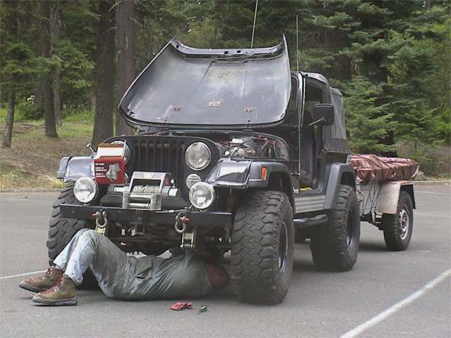
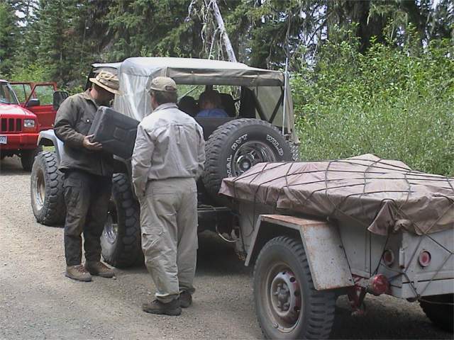
On the way to the start of Leg 3 we stopped at Immigrant Springs park for our lunch stop. We extended the stop a bit to replace the fuel pump in Rick's Jeep.
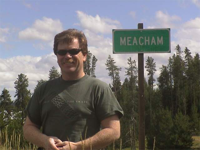
We made a quick stop in the town of Meacham so we could get a photo of Gil posing by the sign bearing his last name. From there on to Jubilee Lake for our evening camping spot. We were a bit worried as at the head of the road leading to the lake was a sign stating that the campground was full. Turns out the weather had turned a bit cold and many people had left the lake. We found several camping spots empty.
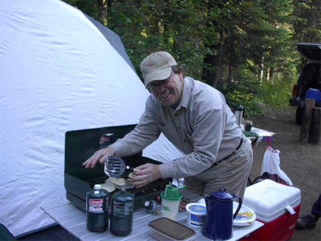
Gil tried his hand at some pancakes for breakfast. Perhaps the griddle wasn't properly seasoned. Whatever the problem, the attempt was quite entertaining.
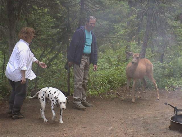
After breakfast a deer wandered into camp. We suspect this deer was somewhat accustomed to humans. Sharkey decided this deer was too small to bother chasing.
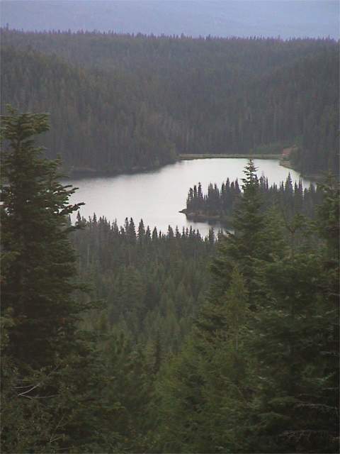
After leaving the camping spot by the lake the trail climbed and provided a beautiful view looking back at the lake.
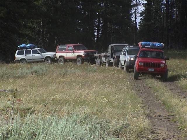
At a turn out for another view, here is the assembled group of vehicles on leg 3.
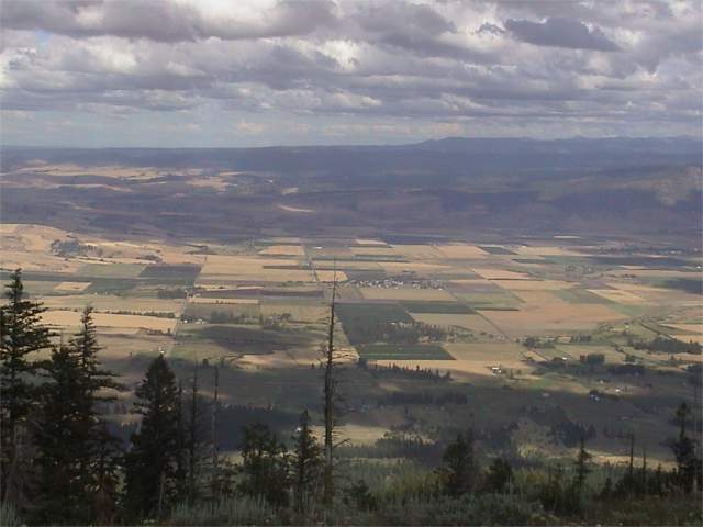
And here is the view from the turnout.
As has been mentioned before - bring gas or make sure someone in the group has some extra gas! Rick's rig was a bit thirsty and near the end of the trip ran out of gas.
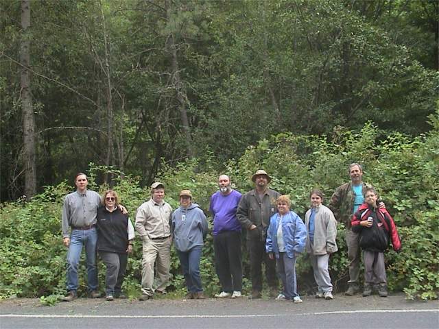
We made it to the Washington border. Here is the group that ran leg 3.
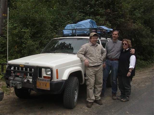
And here we have the 3 that were on each of the three legs making the border to border trip. L,R: Gil Meacham, Dale Mosby, Mary Jo Mosby.
Here is a trip report for this section of the trail. This was written by Gil Meacham, the "trail boss" for the trip.
We no sooner finished leg 2 of the Oregon Back Country Discovery Route than we planned a date to finish the rest of the course. We picked the weekend of July 28th and 29th. After looking at the map and guessing we could plan on an average of 15 miles per hour on the trail, I determined we could drive the remaining section of trail in about 8 hours with lunch and break stops. As it turned out, my estimate was very close.
Since we only planned on 4 hours of trail time, we left Portland at the rather civilized hour of 9 a.m. Saturday morning. Myself and Lynne McMaster joined Sharkey, the 4x4 dog, in my 2000 Cherokee and we met with Dale and Mary Jo Mosby in their 2000 Cherokee. Next to join our group was Dick Hamilton in the X-Terra. Dick had traveled the lower section of the OBCDR with another group earlier, and was anxious to return and get another portion of the trail under his belt. Dick was running solo.
Soon after leaving Portland, I heard Dale mention on the 2 meter radio that a Bronco with an Oregon BushHacker sticker on the back window was passing him. About that time, he passed me. I gave him a shout on the CB, and found out it was Michael Soots, and I had confused him with my directions. Luckily he was quick to correct for my poor instructions.
We made good time driving to The Dalles, where we picked up our last expedition member. Rick with his two daughters in his 197? CJ7 pulling a military trailer. We were early, but we were able to pick up Rick on the CB and rendezvoused at the gas station. On the first long climb out of The Dalles, Rick called up to me and complained that the Jeep was pinging badly. Rick suspected that he got some bad gas in The Dalles. He seemed to do ok, as long as we didn't run too fast. We tried some octane booster, but the pinging continued to be a problem. During the lunch stop at Immigrant Springs just outside of Meacham, Rick discovered he had a leaky fuel pump. I went back to Pendleton and picked up a new pump for Rick. Within an hour from the time Rick discovered the leak he was fixed up and back on the road. The only problem may be that he leaked some fuel before he found the problem.
After taking a few obligatory pics of me below the "Meacham" sign (after all, it is my last name and it isn't quite as common as Smith) we headed for the point where we left the trail. I was driving, and Lynne was navigating with the GPS and laptop. We flew right past the indicated start of the route, and in a few minutes we determined it was a small two track that went up into the trees. For all the world it looked just like somebody's driveway. Once we were on the right map scale, it was apparent this was the route. After crossing I-84 the route turned into a very wide maintained gravel route.
We drove the route up to the top of the rim overlooking the Grande Ronde River. At that point we picked up the Grand View Drive which is a gravel route that follows along the rim. It is spectacular, and well worth a side trip to check it out whenever traveling in this area.
We saw several deer and a few coyotes running along the hills. It was getting to be late in the afternoon, and the animals were moving to their evening watering holes. We pushed on to Jubilee Lake. Jubilee is off the route a couple of miles, but it has a very nice fee campground around a pretty little lake. We set about finding available tent sites for 5 vehicles with 10 people. We found a couple of nice sites across the road from each other, and set up camp for the night. After a great dinner we watched he stars over the lake and turned in.
It was chilly the next morning, but soon warmed up with the sun. Much ado was made over my burning up (literally) the pancakes on my new griddle. Not to worry, plenty of bagels, granola, and Starbucks coffee to fill the hunger.
After striking camp, we started up the road to rejoin the trail. After a couple of blocked shortcuts, we found we had to go back to the point where we left the trail the night before. Apparently there is so much deadfall on the cutoff road it is closed. Had the cutoff road been open, we could have saved almost an hour of driving time on the trail. That isn't really too big of a deal, since the ride was enjoyable and afforded some nice views into the canyons to the west of the ridge west of Jubilee Lake. At one point we drove a side road up the spine of the ridge and caught nice views of the area around us.
After another hour of driving down off the ridge we started to see the pines turn to grassy steep slopes. Soon after that, we got a call on the CB that Rick was out of gas. I pulled the gerri can off my Cherokee and put 4 gallons into the CJ. That was enough to get Rick back to civilization.
The rest of the trail winds its way down into the canyon along the Walla Walla river tributary creeks. We were about to exit the canyon when we saw several houses and some very eclectic communal living quarters. soon after those placed, we came to the Oregon/Washington state line. We had completed our expedition. The state line is very unpretentious and not even well marked. We knew we were there mainly because of the GPS. We all piled out of our rigs and took a group picture to celebrate. Back into the rigs and into Walla Walla for much needed gas. We did a circuitous route to find out that the only Sunday gas in Walla Wall happens to be downtown.
At the fuel station, we said our goodbyes and then headed back to Portland. We were driving along the Walla Walla river through high desert country. Halfway between Walla Walla and Boardman, Oregon we drove through the smoldering area of a range fire. It appeared the fire was started by the trains, as it seemed to head south (downwind) from the train tracks. There were many telephone poles that had burned in two, with the tops of the poles suspended by the wires. A couple of homes and a tiny RV camp were the only green areas left. They had been watered to successfully stave off the fire. It appeared there were thousands of acres burned, and some small pockets of fire were still burning. It was surrealistic to be driving through the blacked smoldering remains of the fire on the asphalt highway. The highway was still pristine.
The rest of the trip from Boardman to Portland was uneventful. The last leg was relaxed two day round trip from Portland. As with many of the areas along the Back Country Discovery Trip, I will be back to enjoy more time along these trails.
Our thanks to the people who volunteered their time to create the map of the Oregon Back Country Discovery Route. It is exactly what the name says. The route follows back country roads, and in good weather it is not a challenge for a 4 wheel drive vehicle with adequate clearance. In snow or rain, it could be a lot more challenging, but even without the hard core 4 wheeling, the route is well worth the effort to follow from end to end.
We had traveled well over 700 miles along the trail in a total of about 7 days of driving. We probably averaged between 10 to 15 miles an hour along the trip, and could easily have spend more time if the weather had been poor. The best time to run the route is in the summer months. Before mid June and after Labor day you may run into deep snow on the higher sections. In a sense, we were lucky that the winter of 2000/2001 had been a very mild one, and the drifts were almost off the start of the route on Memorial Day.
This route is a great way to learn new places in the back country. By traveling this route, it is your responsibility to help preserve and maintain the areas it goes through. Stay on the roads defined by the route. Do not bypass through meadows or other sensitive grass lands. If you want to go off road to explore, do it on foot, and be sure to leave the area a little cleaner than you found it. Tread Lightly!
Bwana Gil